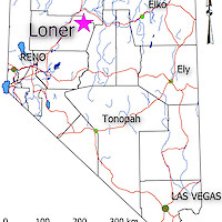
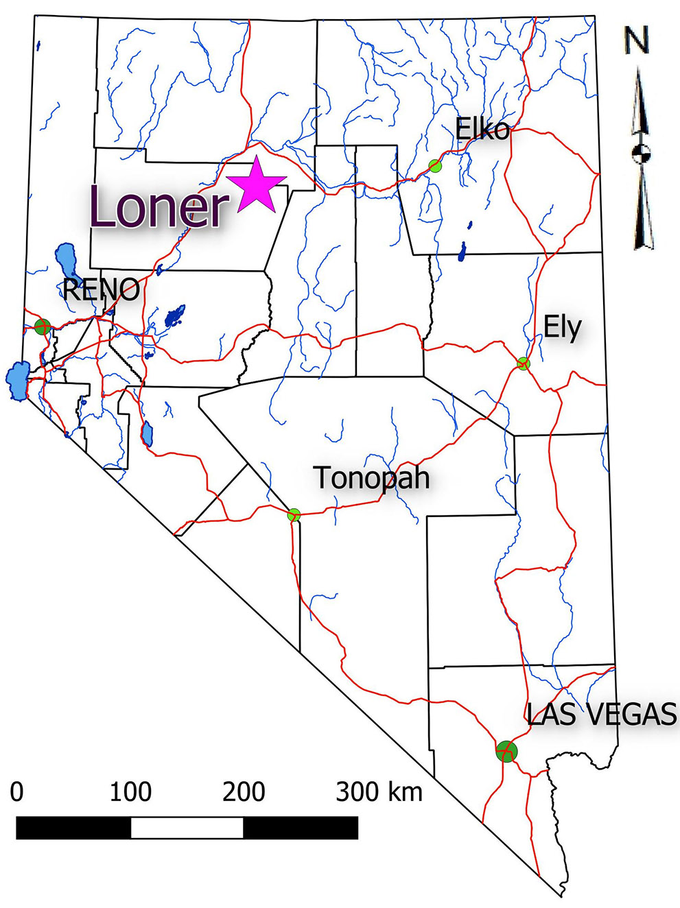
The Loner Property is located in Pershing County, 35 km south of Winnemucca and covers a series of shafts, adits, trenches, and open stopes driven on quartz veins in host granitic rocks near Washoke Canyon. The project is across Grass Valley and 12 miles north of the Goldbanks Deposit (current resources 557,000 oz Au). There are strong similarities between Loner and the Goldbanks Deposit in terms of geological setting and style of mineralization found at each.
Mineralization at Loner was discovered by C. F. Carpenter who recorded the first claims in 1906. A small two-stamp mill was erected in the area in 1915 and shipments totaling 30 tons of hand-cobbed ore grading 2.5 OPT Au and 15 OPT Ag were recorded in 1933 and 1934 by L.E. Case. Another shipment of 37.5 tons of raw ore grading 0.38 OPT Au was made in 1935. NBMG records indicate the deepest shaft on the property is 90 feet and there were approximately 1000 feet of underground workings. Since 1986, the property has been staked by Newmont Mining (1986-1988), Santa Fe Pacific (1986-1988), St. Joe American Corp. (1987-2000) and a number of private companies. The property was restaked by Silver Range Resources in 2018 and subsequently explored with a soil geochemical survey in 2019.
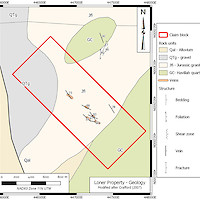
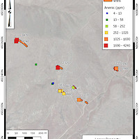
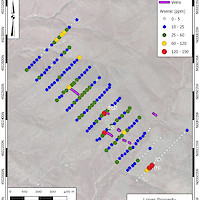
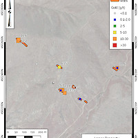
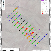
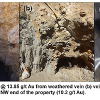
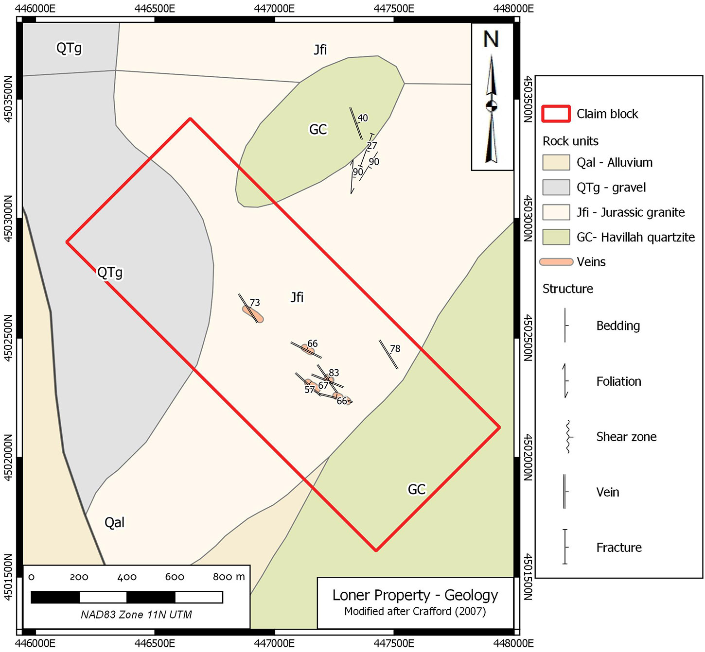
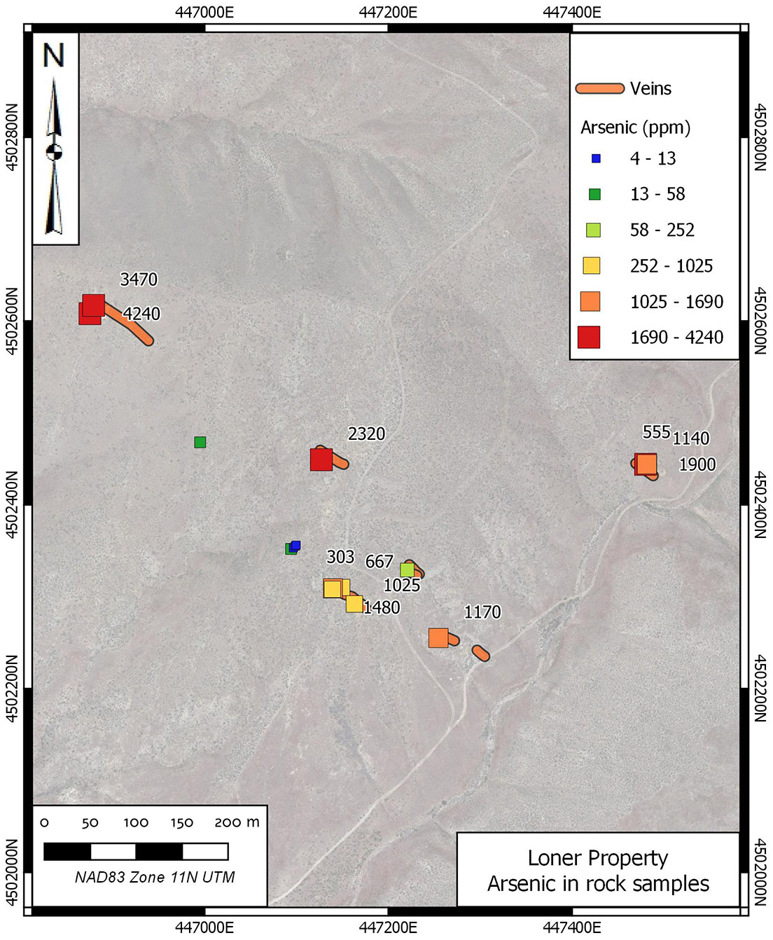
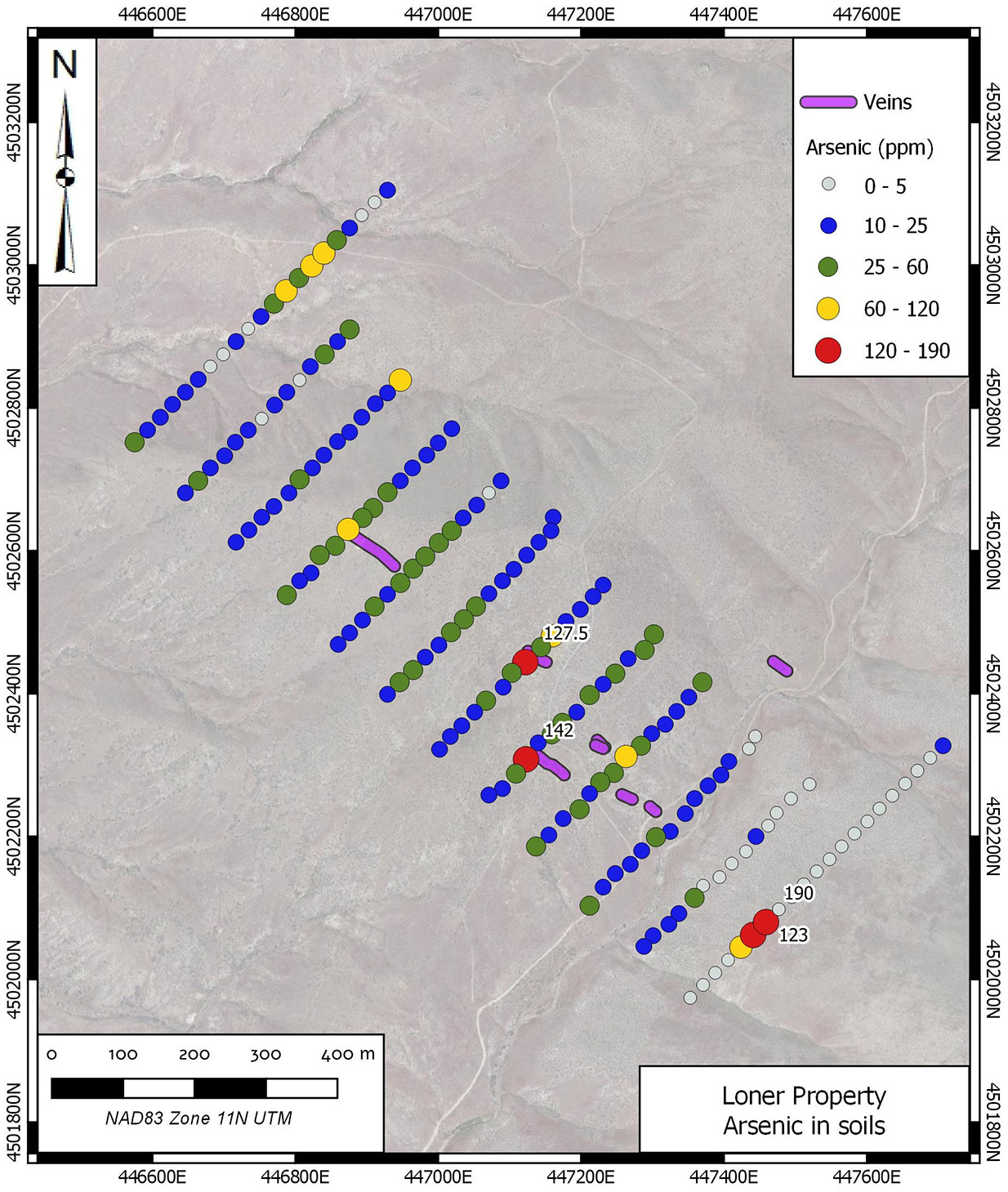
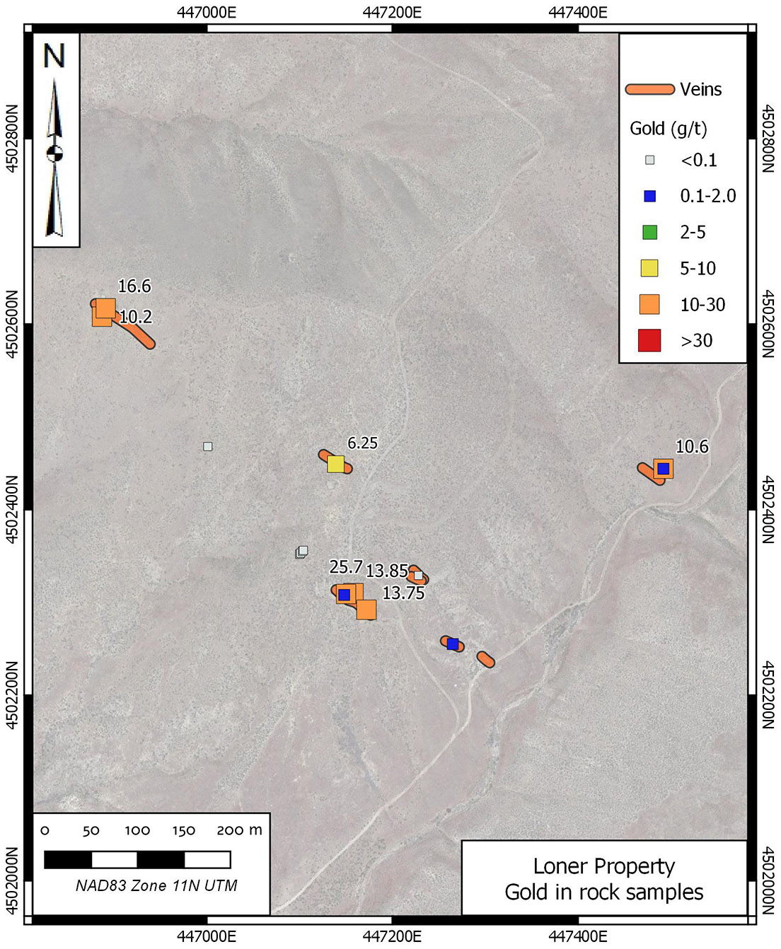
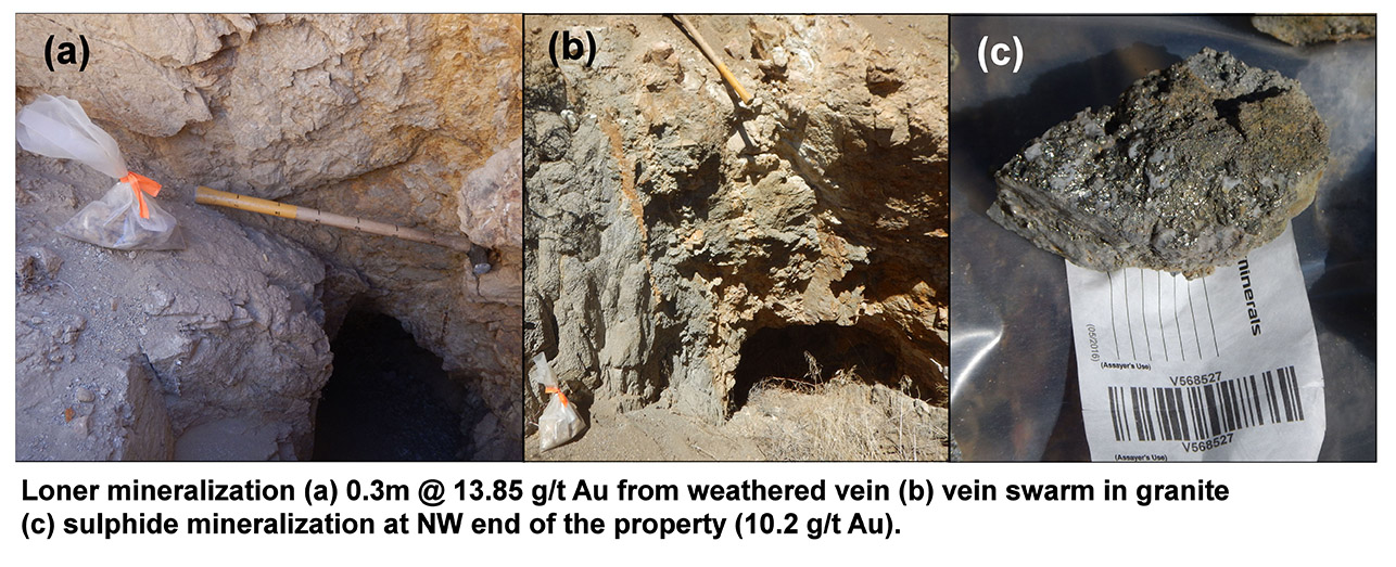
The Loner Property is underlain by Tertiary granite & granodiorite and small roof pendants of older metamorphosed andesite and argillites. At the principle showings, the granodiorite is cut by a series of WNW to NW striking, NE dipping quartz-adularia-clay veins from 0.5 to 2.0 m wide. In the southeastern portion of the claims, the veins contain trace to weakly disseminated sulphides whereas to the northwest, another vein system contains heavy concentrations of arsenical marcasite and pyrite. With the exception of the shaft dump mineralization at the northwest showing, all other recovered vein material recovered is heavily oxidized to black, orange and yellow wad. The exposed mineralization is notably high grade; 6 of 8 samples recovered from the workings during reconnaissance returned assays greater than 6.0 g/t Au. Best grab sample results were 16.60 g/t Au from a select waste dump specimen and the best channel sample returned 1.83 m @ 25.7 g/t Au from the brow of an adit in the main mine workings. Mineralized specimens also returned high values of arsenic (to 4240 ppm As) and anomalous values of phosphorus (to 1020 ppm P).
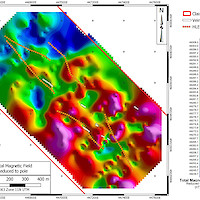
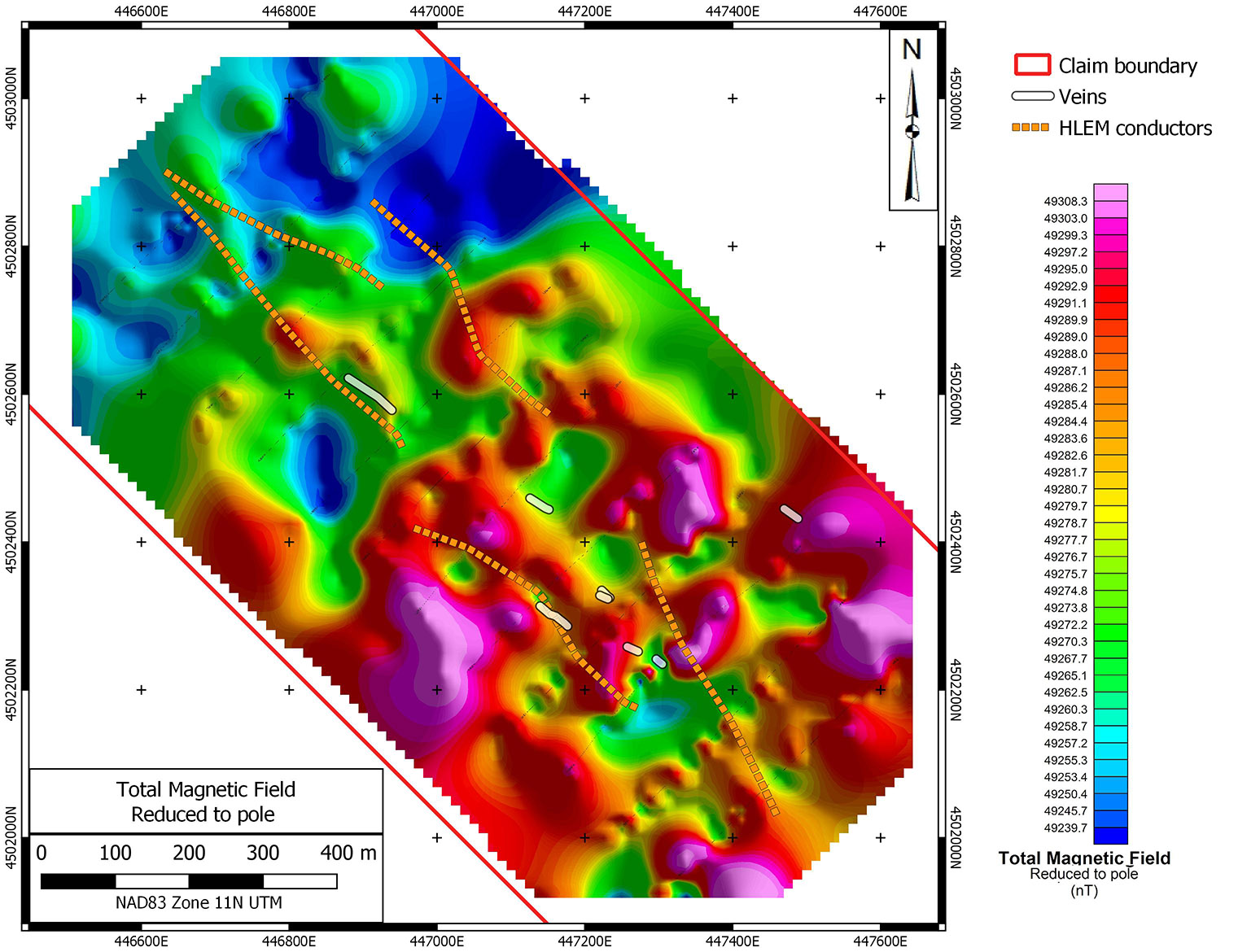
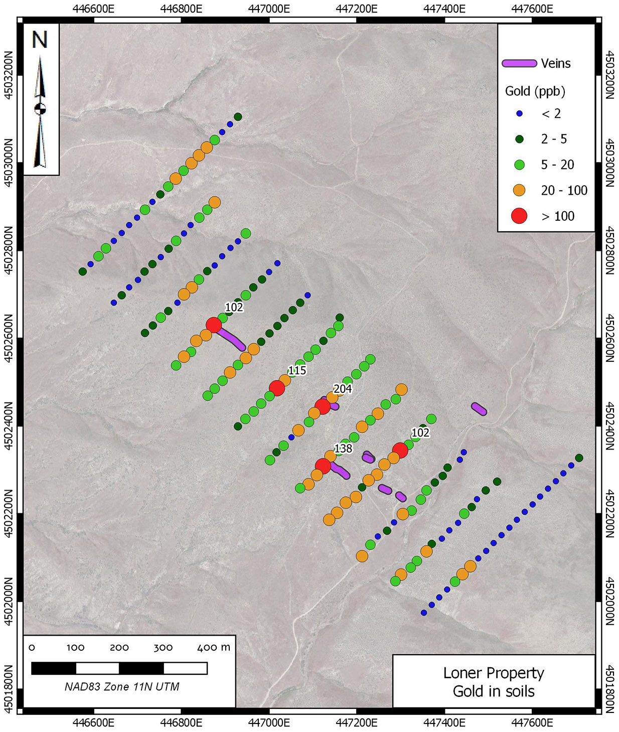
There is a large soil geochemical anomaly associated with the surface mineralization. Horizontal loop electromagnetic field surveys have defined bedrock conductors associated with the known surface showings.
Silver Range intends to significantly expand the existing soil geochemical grid to define the limits of gold and arsenic anomalies. This would be followed by trenching to define drill targets