The Hannapah Project is located 28 kilometres east of Tonopah in Nye County. It is readily accessible from Highway 6 via an extensive network of four-wheel drive roads.
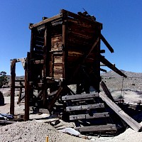
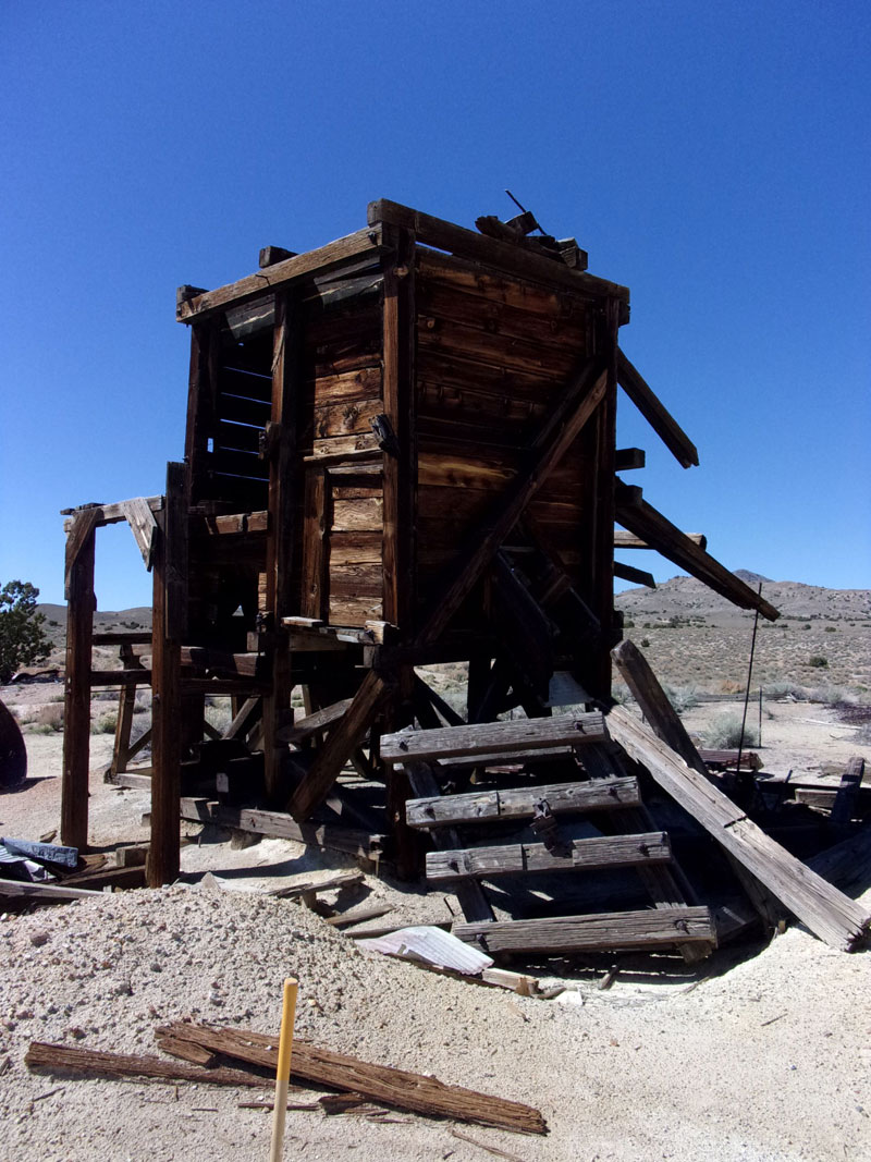
High grade silver and lesser gold mineralization were discovered in the Hannapah Mining District, likely in 1870. A small shipment is recorded from the district in 1871. Development took off following the discovery of silver at Tonopah in 1900. In 1902, promoters from Utah optioned what became the Hannapah Mine. Between 1902 and 1907 the company sank two shafts and made several small shipments before the surface workings were lost in a fire. In 1907, Ben Richardson staked the Richardson mine adjacent to the Hannapah Mine and worked on the property until his tragic death in 1935 following an accident at the mine. He made numerous shipments of high-grade silver ore from the Richardson Mine, the Silver Leaf and other properties in the district over a period of nearly 30 years. The Silver Glance Mine northwest of the Hannapah Mine was staked by a syndicate of prospectors in 1905 and mined from 1905 to 1907. Nevada Bureau of Mines and Geology reports indicate $300,000 may have been taken from the property in this period. In 1907 it was optioned by the Silver Glance Mining Company and developed from 1907 to 1909. It had a brief resurgence in 1930. There are other smaller high-grade producing prospects in the district including the Silver Star, Silver Leaf and Hornsilver which were explored during this period. In recent times, the Hannapah District has been explored Wolfpack Gold, Pilot Gold, Kinross and Seabridge Gold. The Richardson Mine was re-staked by Silver Range in 2017 and surrounding ground was staked by Mercury Nevada Exploration Inc. in 2019. In 2020, the Project was briefly optioned to Infield Minerals Corp. who ran an airborne total magnetic field survey and mapping and sampling programs. Infiield returned the property the following year. Mercury completed an additional airborne aeromagnetic survey over the property in 2021 and Silver Range completed a three-dimensional inversion of the consolidated aeromagnetic data in 2022.
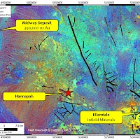
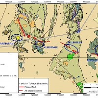
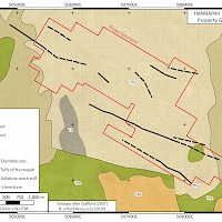
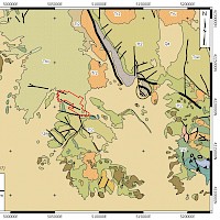
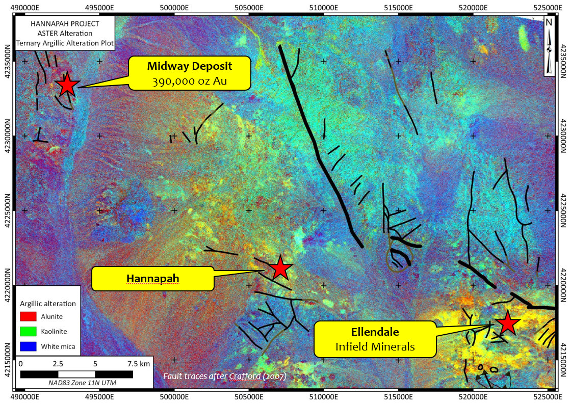
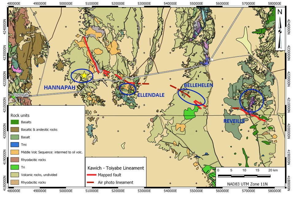
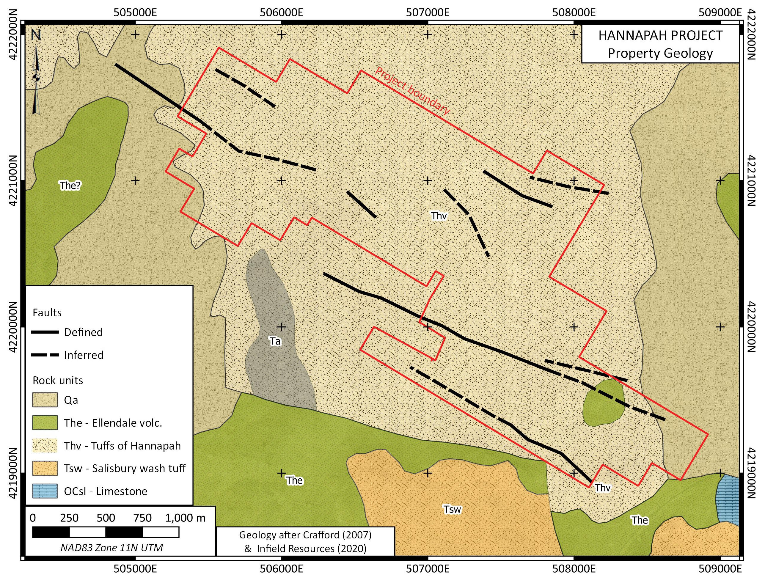
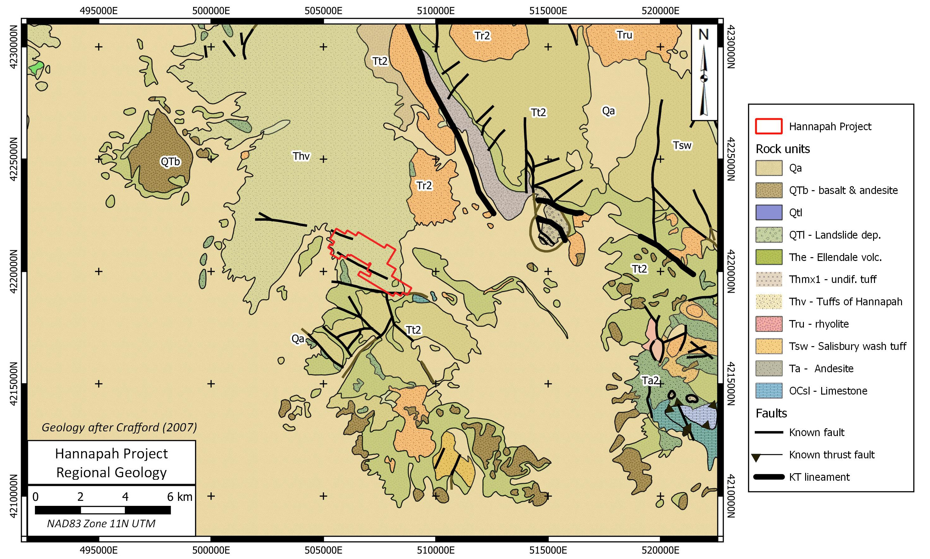
The property is underlain by Oligocene volcaniclastic rocks and lesser rhyolite cut by west-northwest trending faults. These structures host low sulphidation epithermal silver – gold mineralization in veins and stockworks. The faults are possibly part of a much larger horse-tail fracture zone at the western termination of the Kawich Toiyabe Lineament. This prominent regional structure, either a strike slip or normal fault, extends for 80 km from the Reveille Range in the east to the Monitor Range, east of Tonopah. The Reville, Bellehelen, Ellendale and Hannapah Mining Districts – all host to epithermal gold & silver mineralization – occur along the Kawich Toyaibe Lineament. ASTER hyperspectral data and structural considerations indicate that the Hannapah Project lies in a zone of horse-tail fault deformation marking the end of the structure.
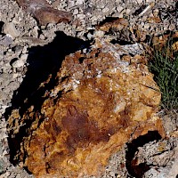
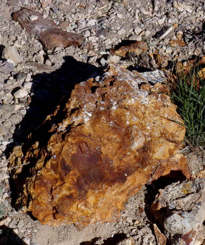
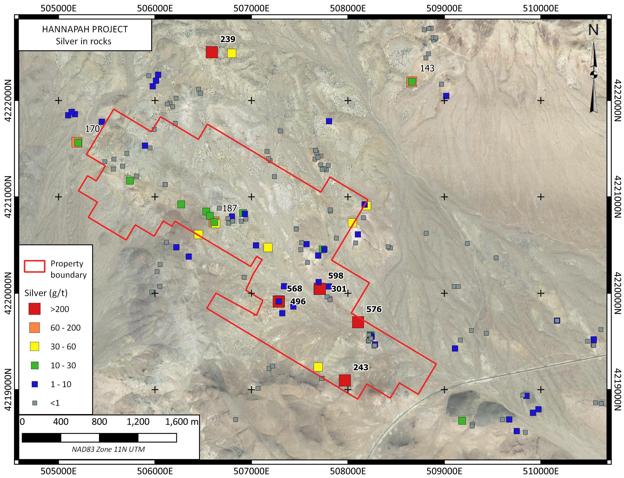
On the property, quartz-limonite-goethite-alunite / jarosite mineralization is found above the water table which occurs at a depth of about 60 m in the district. Quartz-pyrite-polybasite mineralization is found in veins below the level of oxidation and in some mine dump samples. Veins are up to about 4 m wide and persist in networks along strike for hundreds of metres near the Richardson – Hannapah Mine area. Best recent sampling results include 568 g/t Ag and 1.01 g/t Au from a composite sample of dump material at the Richardson Mine; 598 g/t Ag from a nearby grab sample; and 2.42 g/t Au and 301 g/t Ag from altered rhyolite northeast of the Richardson Mine.
Silver Range intends to conduct ground geophysical surveys; alteration and geological mapping; and soil geochemical surveys at Hannapah to map the individual mineralized structures within this extensive epithermal system.
