-
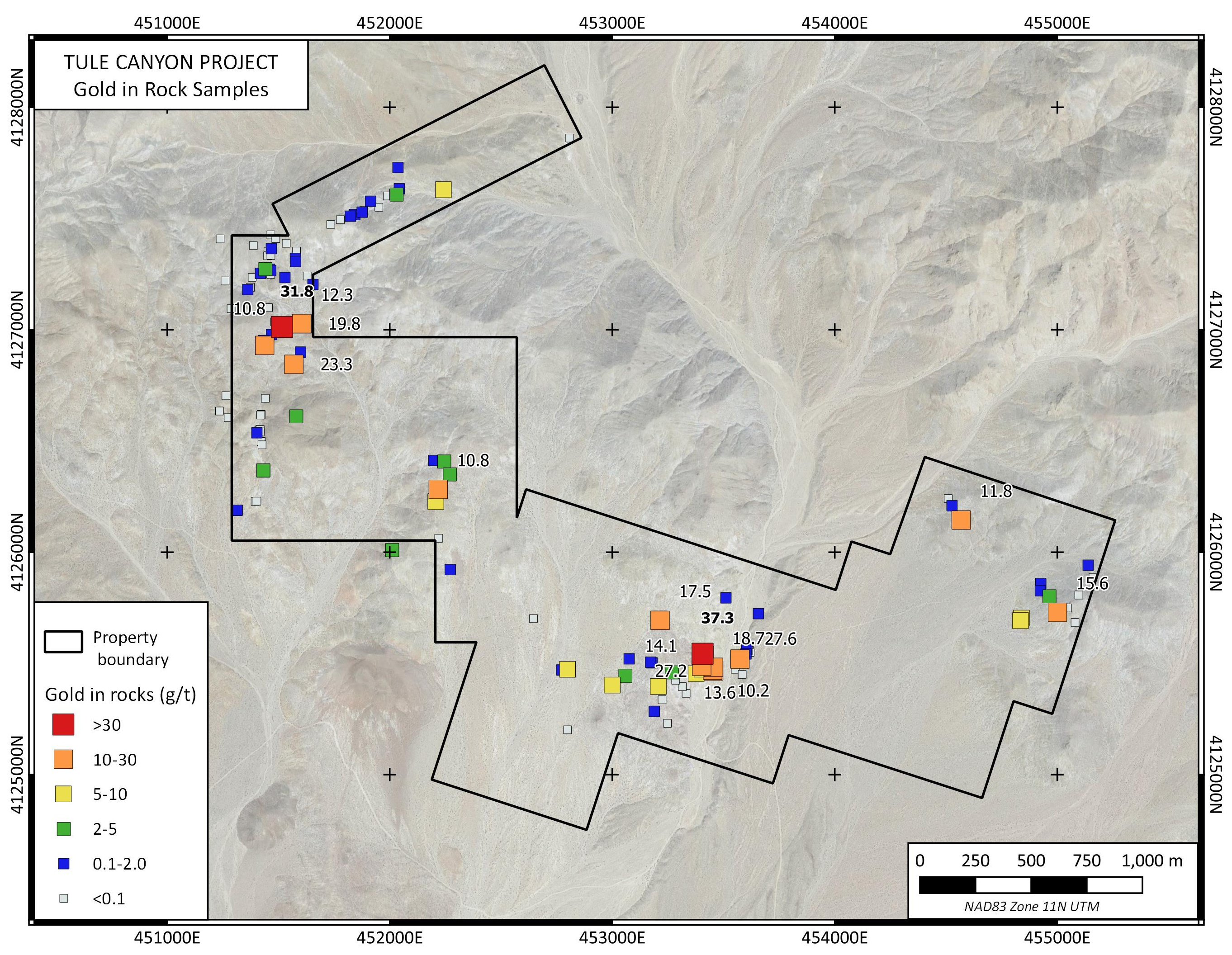
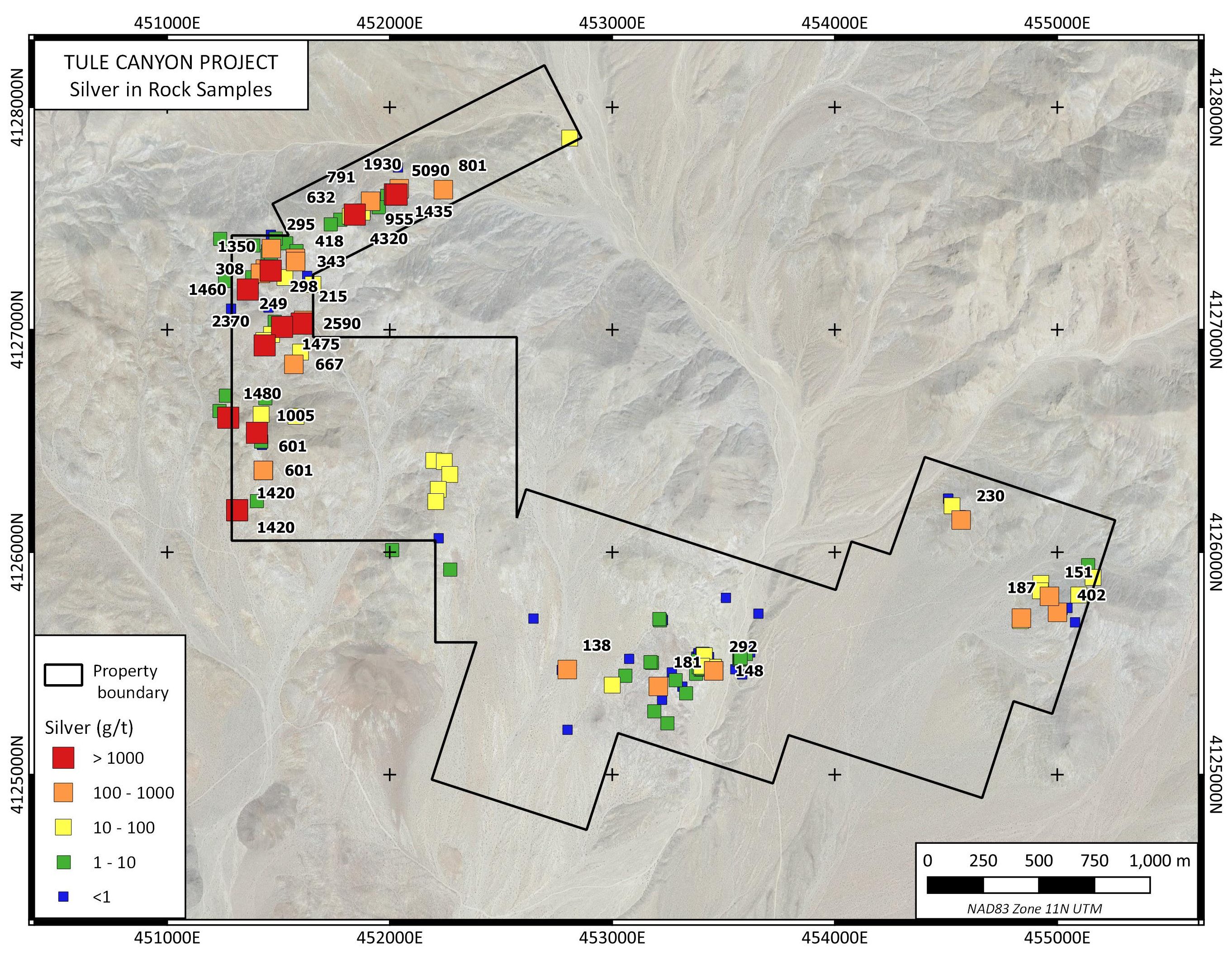
Widespread surface gold and silver mineralization
-
Past production (hard rock and placer)
-
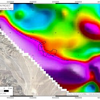
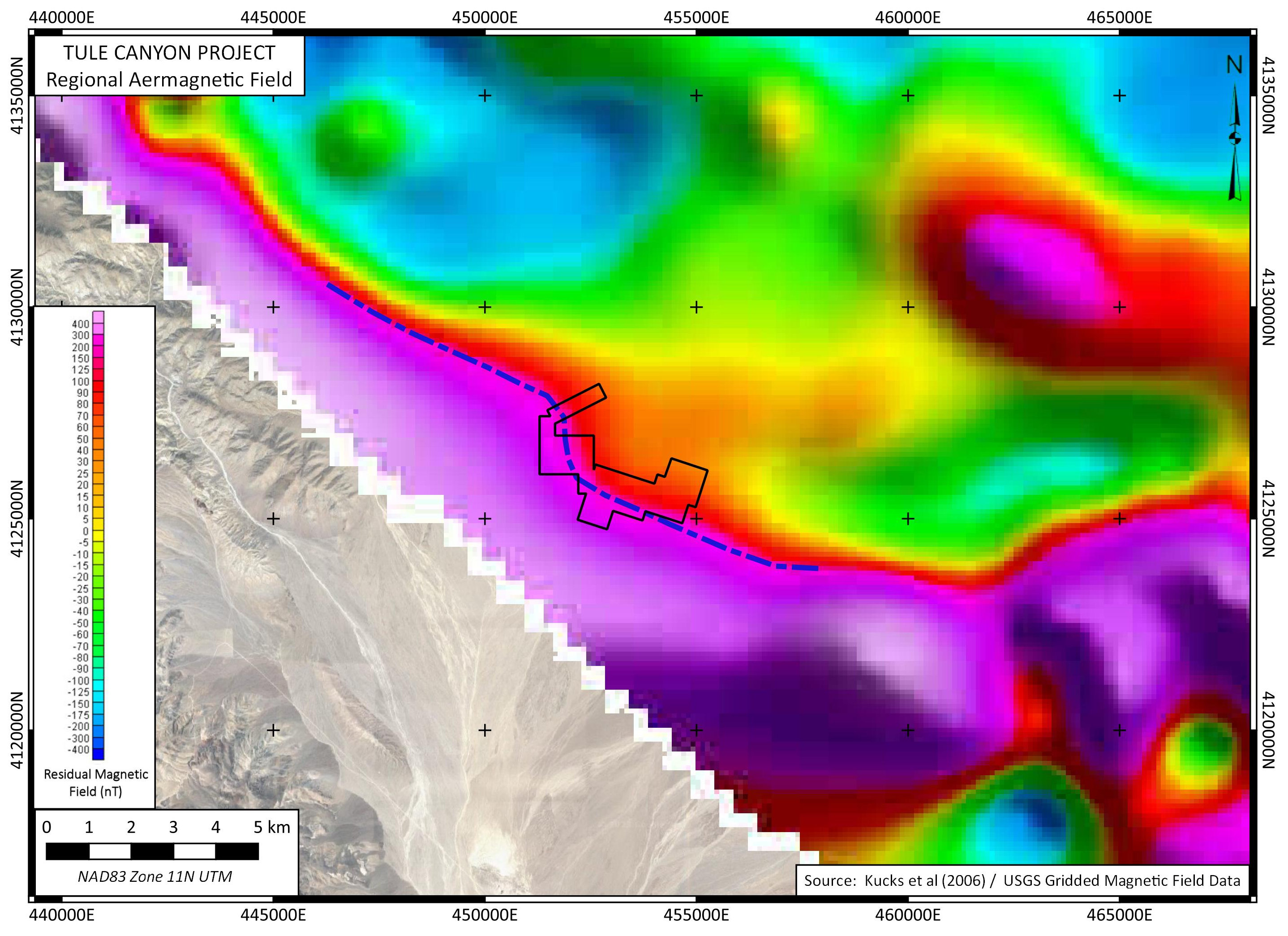
Geophysics defines large targets below and along strike of known showings
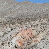
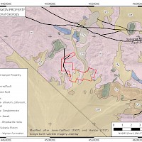
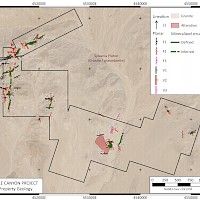
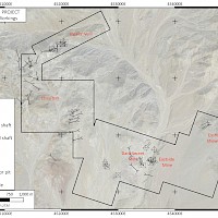
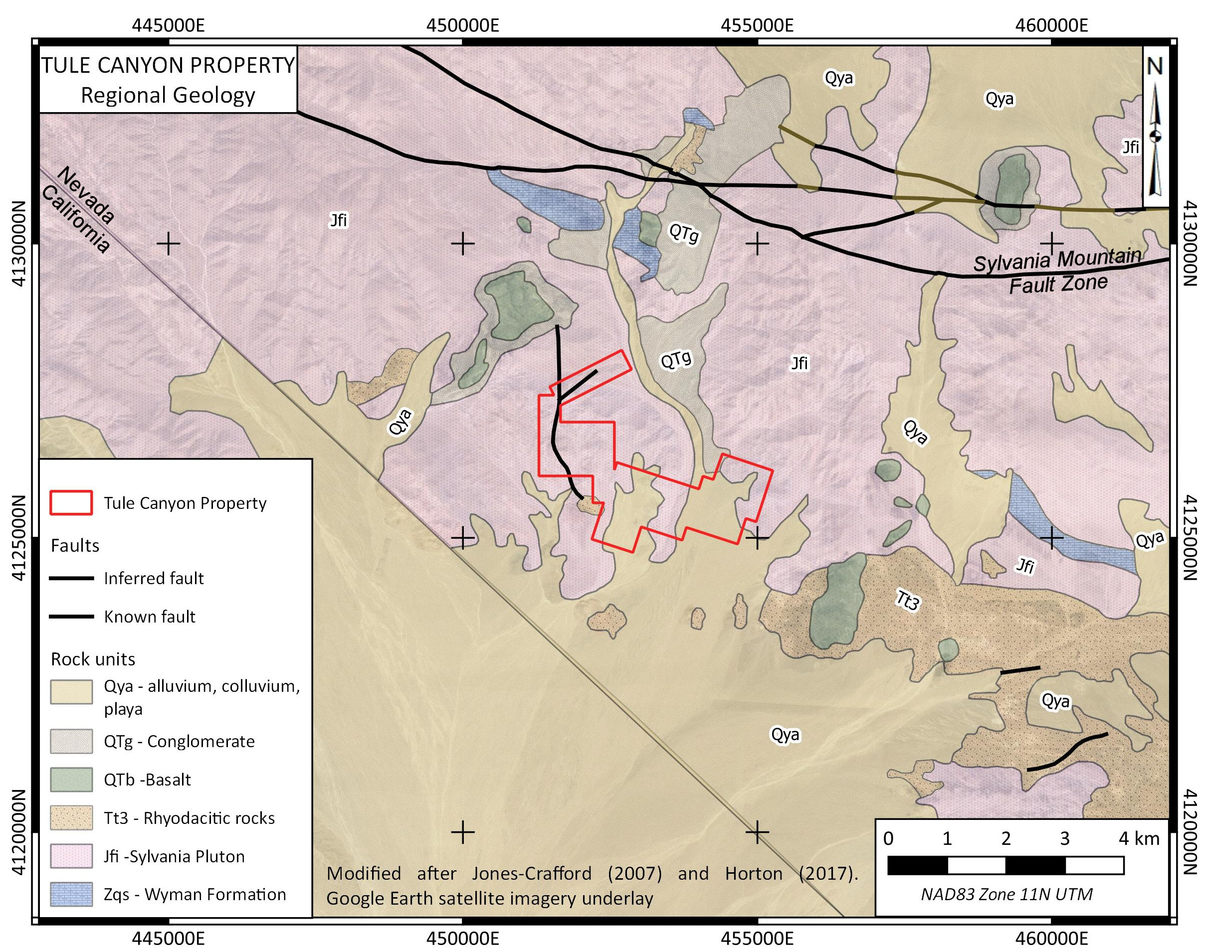
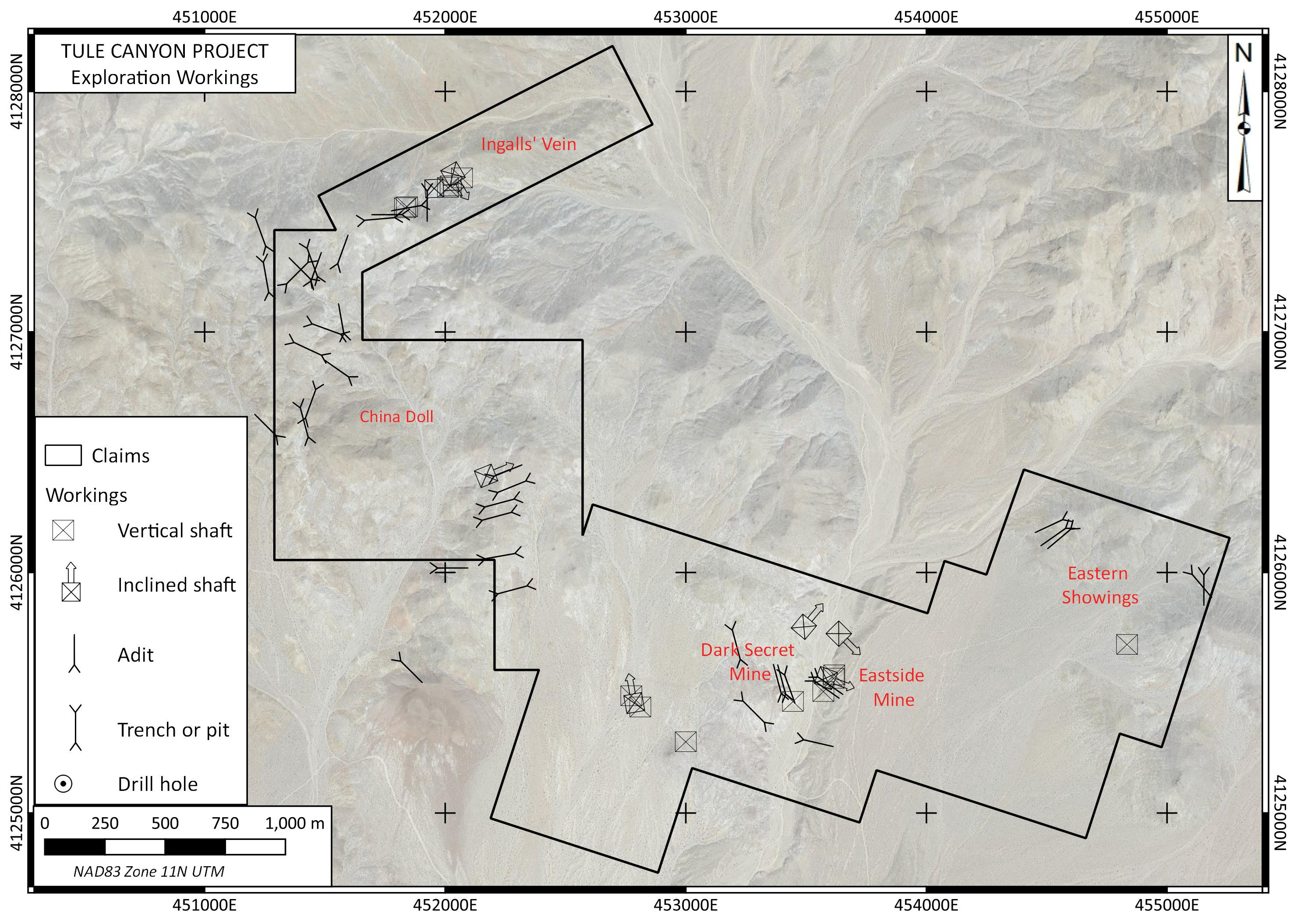
The Tule Canyon property is located is 95 km south of Tonopah and 80 km northwest of Beatty in Esmeralda County, Nevada. The property can be accessed by 4WD vehicle from Gold Point using the county-maintained Tule Canyon Road. The property consists of 58 Federal Lode claims on BLM land with no surface impairments.
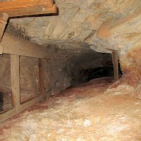
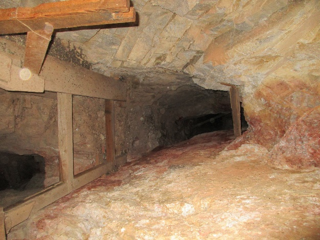
Mining in Tule Canyon dates from prior to 1848 when Mexican placer miners first began work in the area. Placer mining continued intermittently in Tule Canyon until recent times, with a major period of activity during the 1930’s. Hard rock mining in Tule Canyon likely first developed around the Dark Secret Mine, a small hard rock operation from the 1890’s until about the 1930’s. To the north at Roosevelt Wells, operations on the silver-rich vein adjacent to Roosevelt Wells began around 1904, followed by construction of a mill around 1920. Thereafter, hard rock mining activity in the district waned. Later, during the 1970’s or 1980’s, an undocumented underground operation was run on a vein on the east side of Tule Canyon (Eastside Mine) and a small open-pit operation was run on the west side of Tule Canyon. No modern exploration or drilling is documented in the immediate property area.
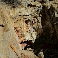
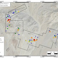
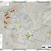
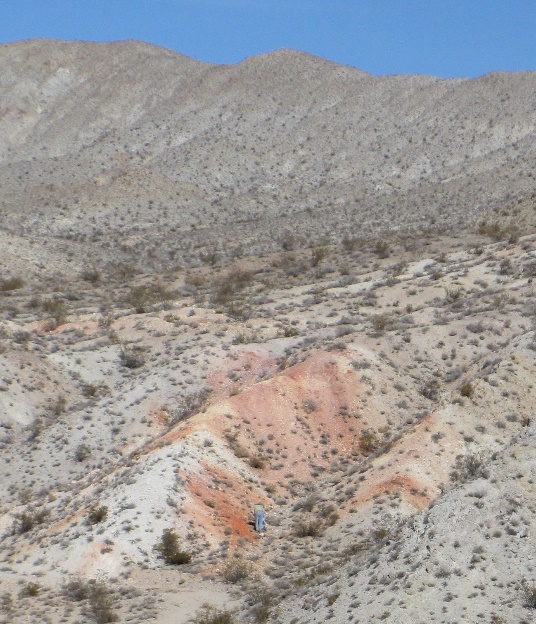
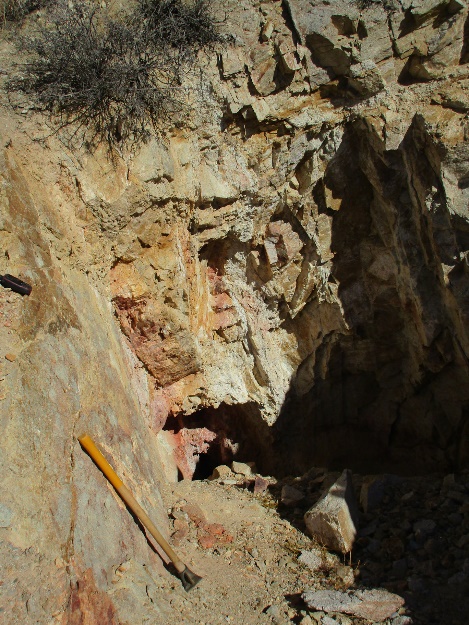
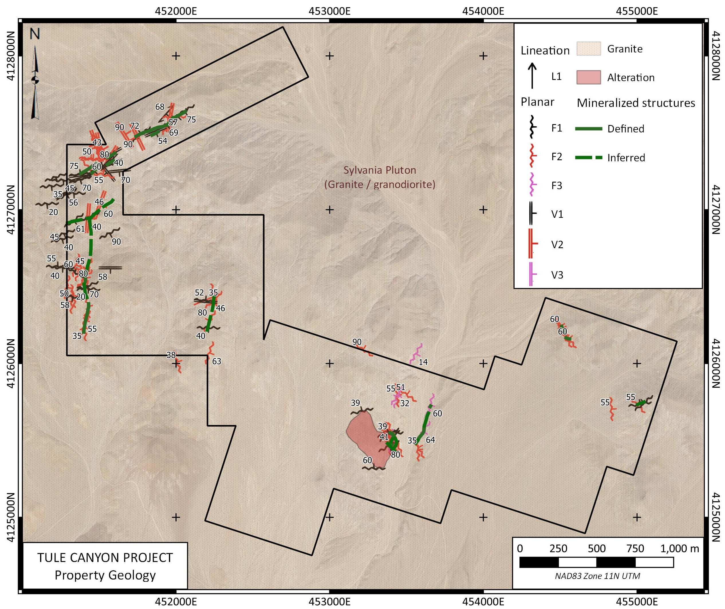
The Tule Canyon Property is underlain by Mid-Jurassic quartz monzonite of the Sylvania Pluton. The country rock is cut by steeply dipping quartz-hematite-limonite veins, locally carrying pyrite and grey sulphides. The veins form a network of dominant N to NE and secondary E to SE striking veins around Tule Canyon extending east and west under cover, forming an apparent east-west corridor of mineralization in the southern extent of the claims. The wall rock is intensely clay altered in the area of the Dark Secret Mine and is enclosed in a large phyllic alteration zone. The veins in the southern portion of the property around the Dark Secret and Eastside mines carry high grade gold with surface grabs to 27.2 g/t Au. At the Eastside Mine, underground grab samples have returned from 5.38 g/t Au to 27.6 g/t Au and a chip sample returned 0.30 m @ 5.25 g/t Au. Mineralization at the Dark Secret Mine includes both high grade veins and a broader low-grade halo. A chip sample across weathered bedrock in the small pit above the underground workings returned 40 m @ 0.469 g/t Au including 20 m @ 0.695 g/t Au. To the north and northwest, steeply-dipping N veering NE trending structures host mineralized veins and breccia within shears that exhibit highly clay-altered silver and gold mineralization with samples returning up to 31.8 g/t Au and 4,320 g/t Ag.
Geological mapping, rock and soil sampling surveys have been completed on the property. They define ~4km structural corridor hosting gold and silver mineralization in high grade sheared veins. Much the property is underlain by shallow cover and remains unexplored. Silver Range believes the project is ready for drill testing.
This property was optioned to Walker Lane Resources in March 2025.