Under Option to a Private British Columbia Company announced August 31, 2022
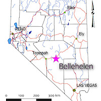
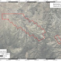
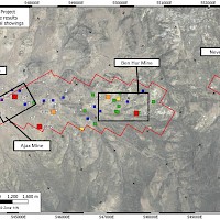
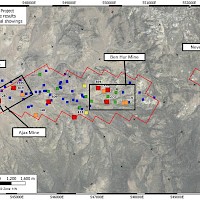
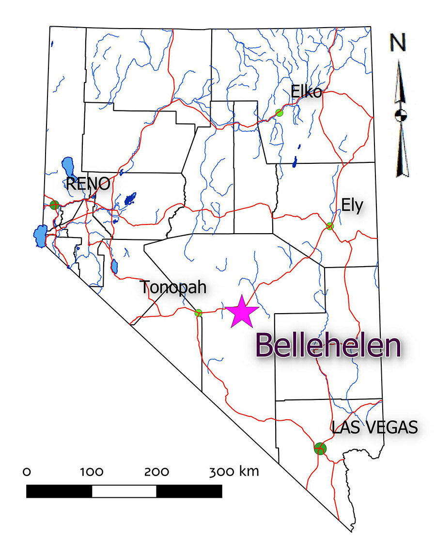
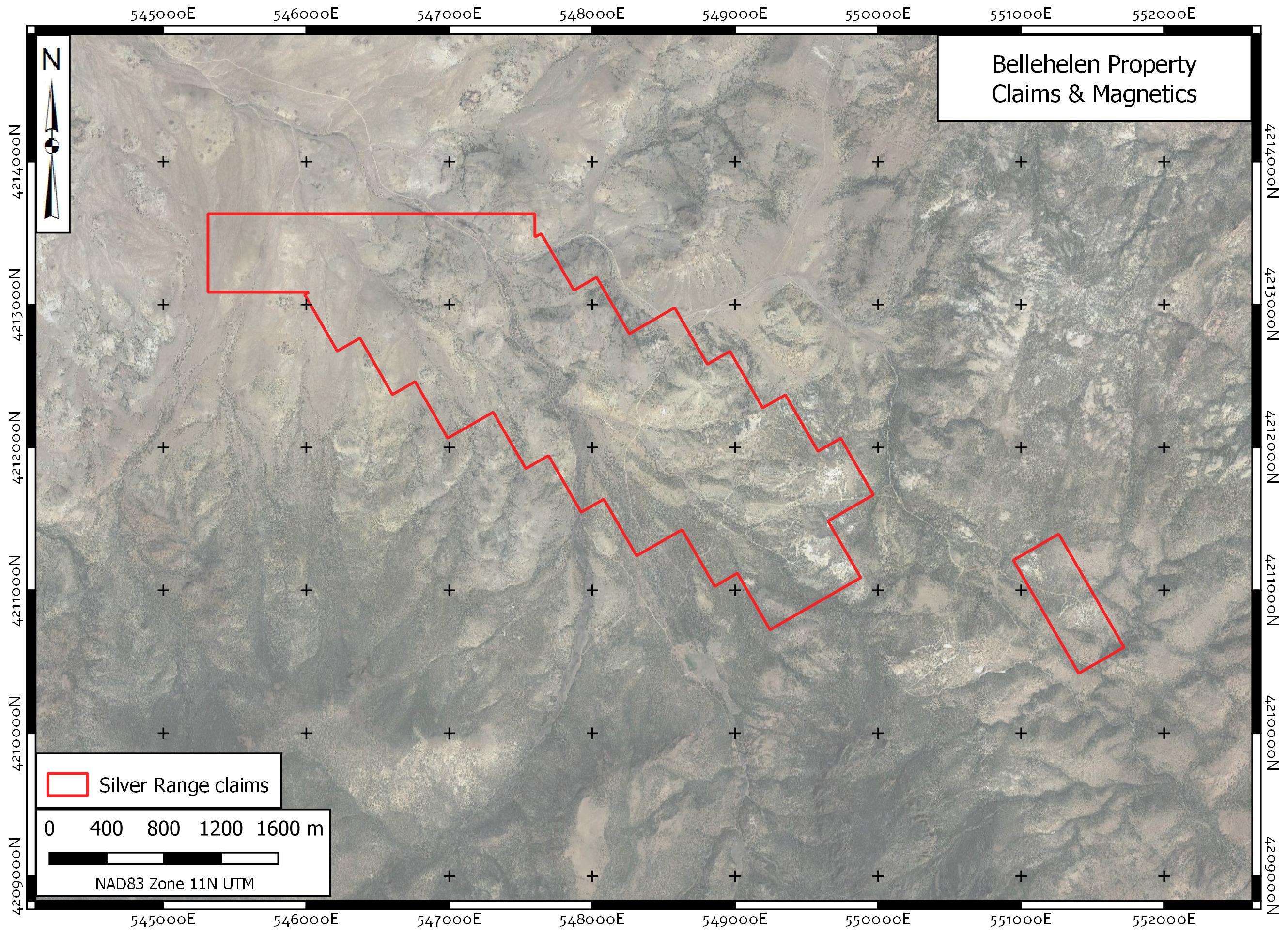
The Bellehelen Project is located in the Bellehelen Mining District, north – central Nye County. The property is 69 kilometres east-southeast of Tonopah and is accessible by road from Highway 6 via the Golden Arrow Road and Bellehelen roads. Both are gravel and much of the latter is best travelled with a 4x4 vehicle. The project consists of three claim blocks located in Township 2N Ranges 49 & 50E and Township 3N Range 49E. Two Silver Range claim blocks (88 claims) cover the principal showings in the district – the Ajax Mine, Ben Hur Mine, Neversweat occurrence and numerous smaller mineral showings. The Bellehelen (Merger) and Peterson Mines in the southern portion of the district are covered by three claims, held since 1954 by the Clifford family in Tonopah. The Bellehelen Project is located on BLM land with no surface impairments excepting that 13 claims partially or entirely lie in a Wilderness Study Area.
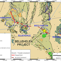
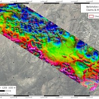
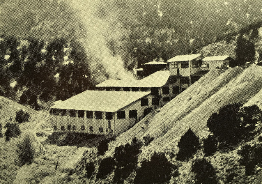
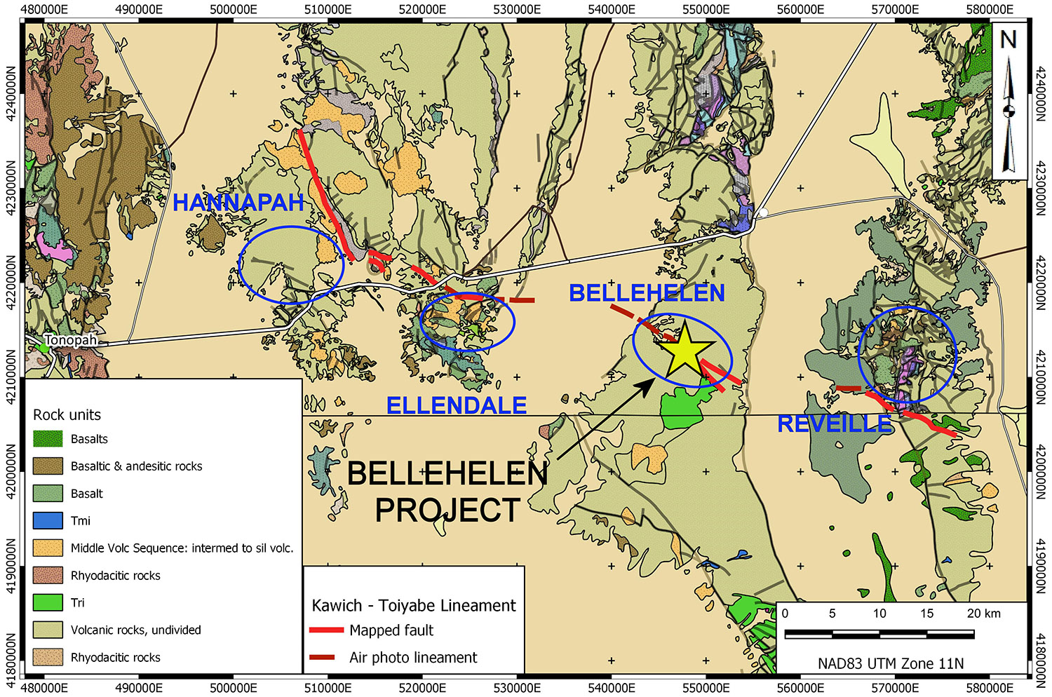
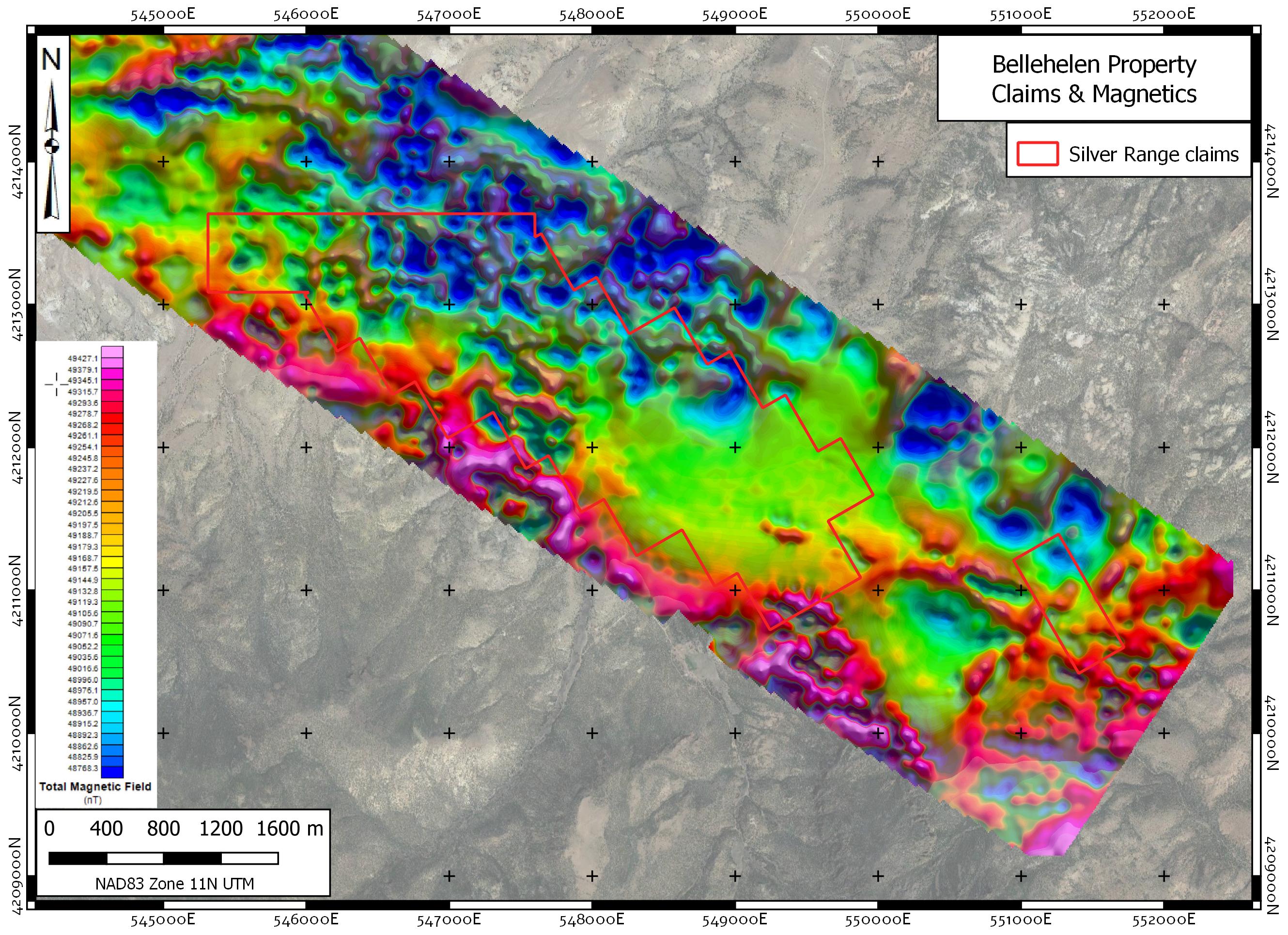
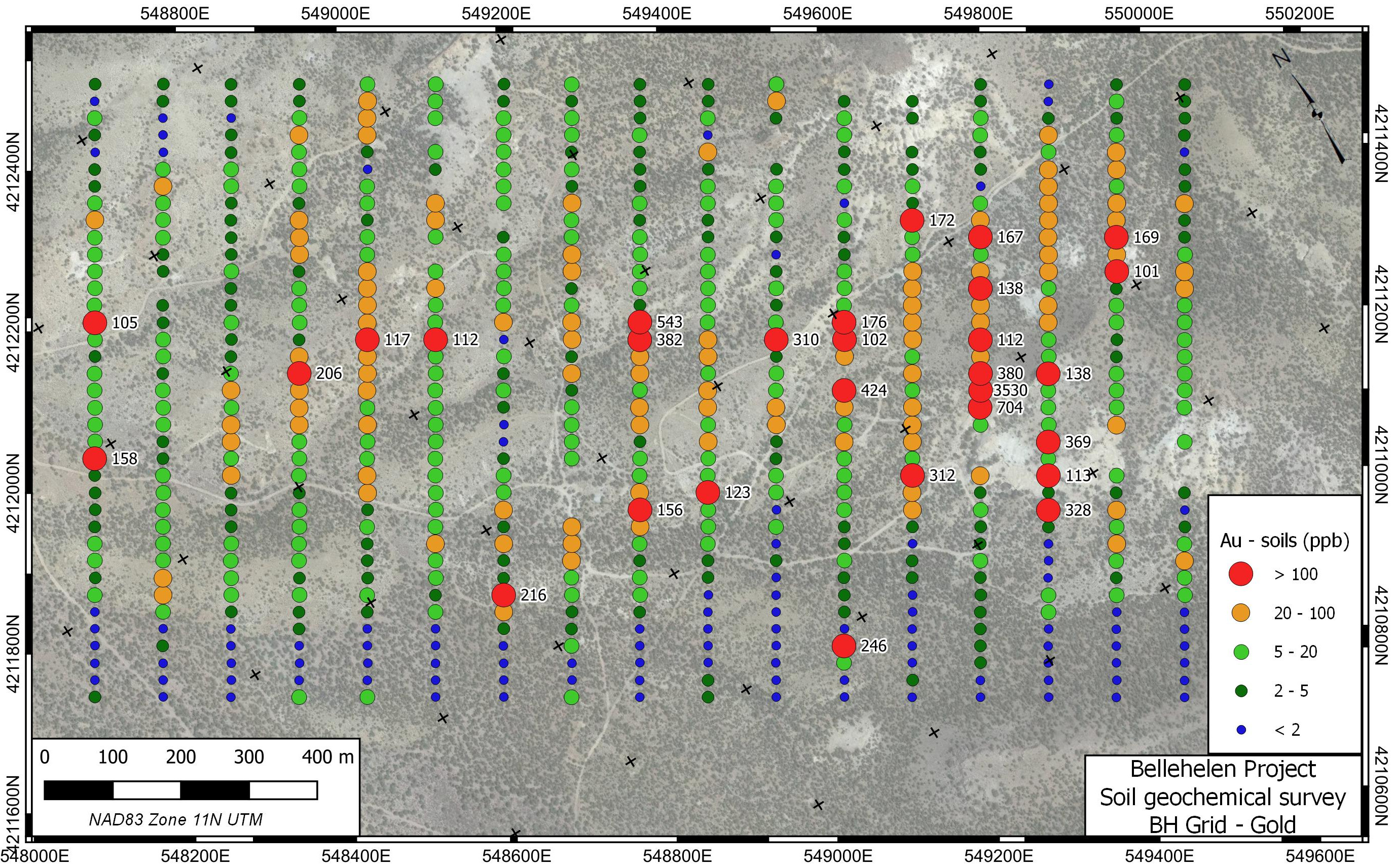
Silver and gold were discovered in the Bellehelen Mining District around 1904. The area saw limited production from 1909 to 1927 and sporadic production during the 1930s. Total documented production, mostly from the Bellehelen (Merger) Mine and adjacent Peterson Mine, is estimated at approximately 311,000 ounces silver-equivalent. This estimate does not include minor production from smaller workings throughout the mining camp. Mineralization in the Bellehelen district is low-sulphidation in character, hosted in secondary E-W striking secondary normal faults within the regional scale Bellehelen Fault Zone, a component of the larger Kawich-Toiyabe Lineament. The project area is entirely underlain by rhyolitic ash flow tuff and megabreccia (crater collapse) deposits of earliest Miocene age. Mineralization likely occurred following crater collapse driven by hydrothermal circulation along master faults in the Bellehelen Fault Zone.
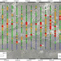
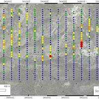
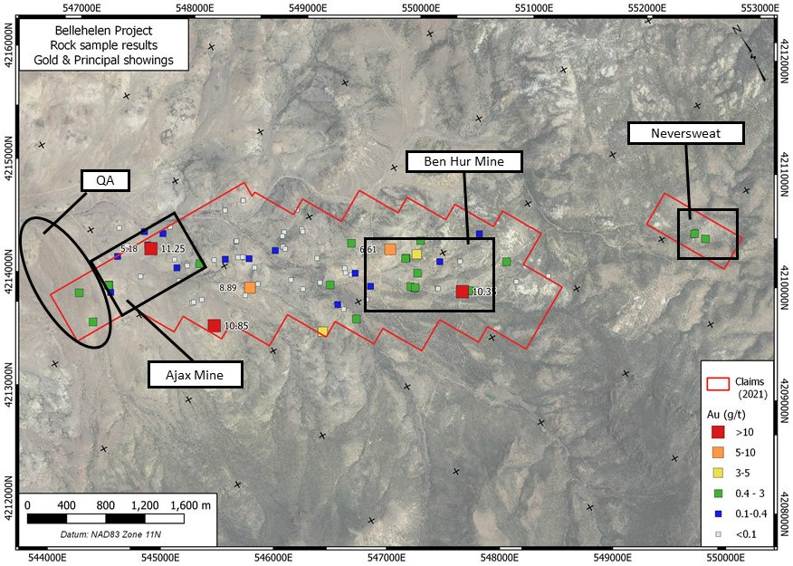
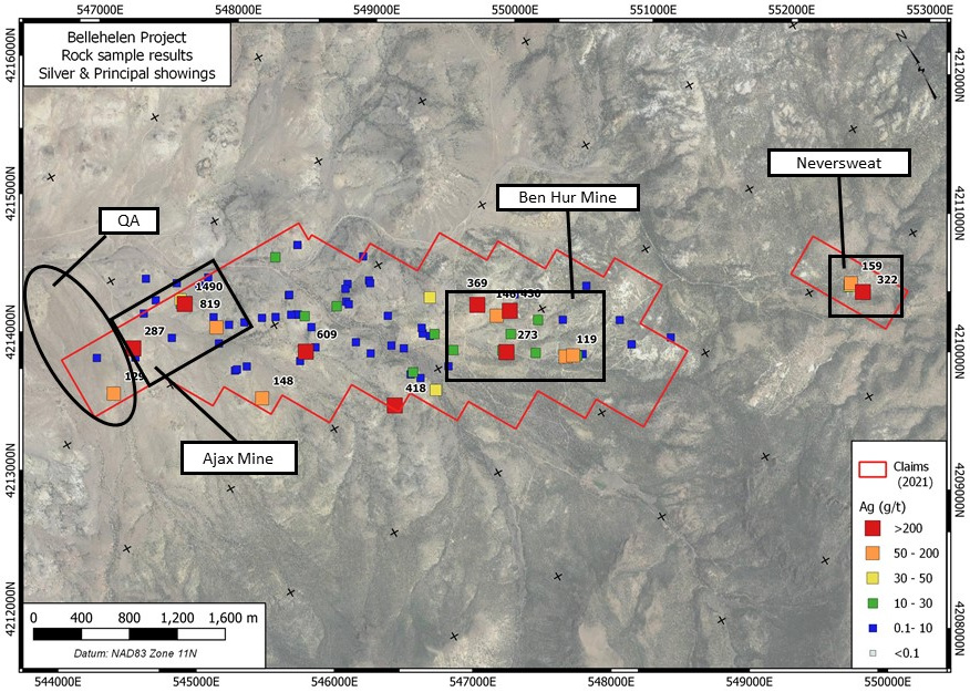
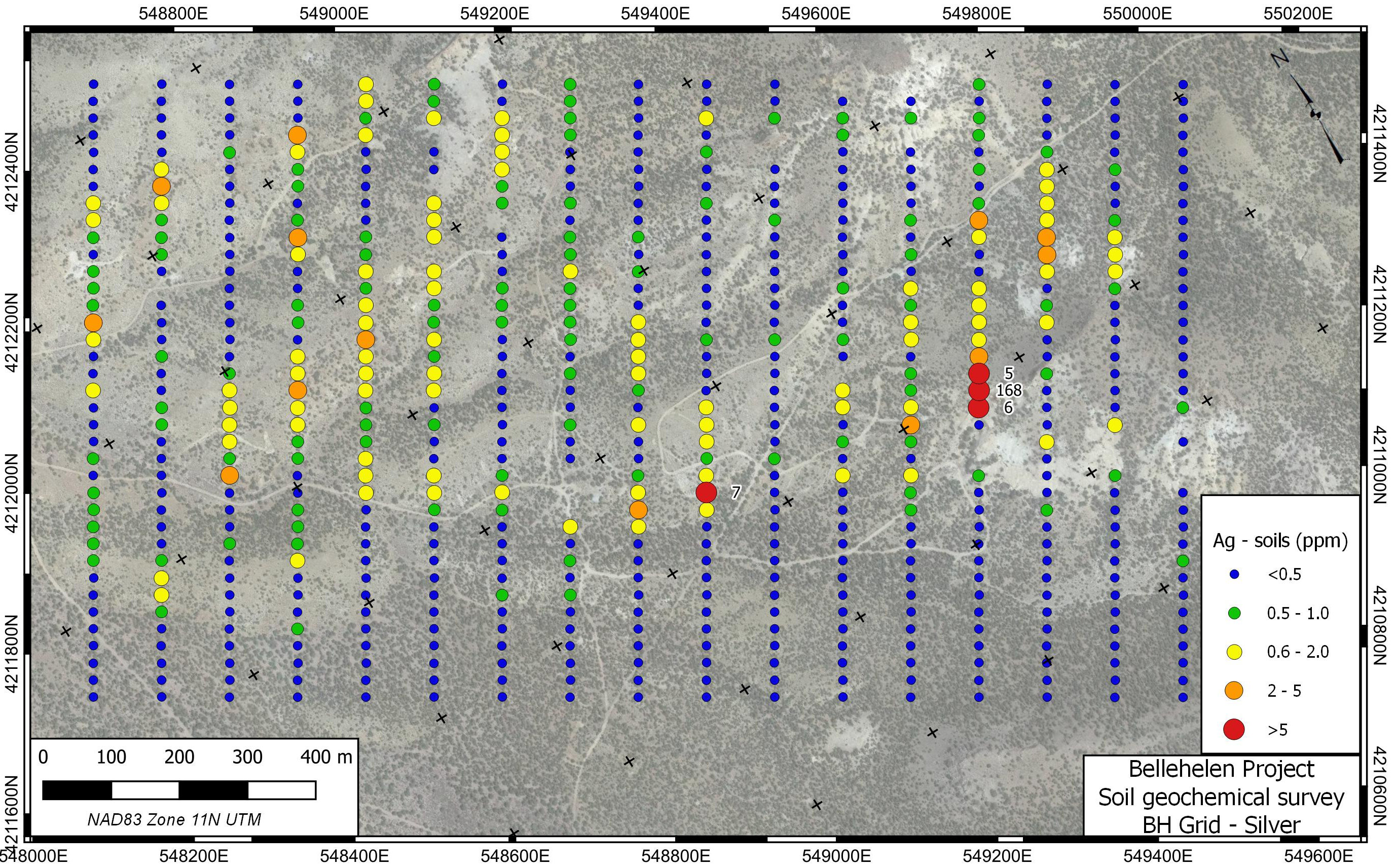
Low-sulphidation epithermal gold & silver mineralization occurs in two settings at the Bellehelen Structurally-controlled low-sulphidation silver & gold style mineralization is found at most of the historic occurrences. Steeply-dipping fracture / shear zones with quartz veinlets and thin stringers host mineralization in this setting. Coarse to chalcedonic (rarely opalescent) quartz with disseminated pyrite and rare galena, cerargyrite and free gold occurs in the district. Most of the vein material is highly oxidized to limonite, goethite and other sulphide alteration products. Nontronite is noted near the Ben Hur Mine. Dump and in-place surface grab samples of this material have returned up to 11.25 g/t Au and 1,490 g/t Ag. Very strong gold-in-soil response is noted with this style of mineralization in the area of the Ben Hur Mine with soil samples running up to 3,530 ppb Au along a trend extending more than 1000 m. The other style of low-sulphidation is stratabound quartz-adularia flooded pyroclastics with disseminated pyrite at the QA grid. Best analyses to date of this potentially extensive material to date are 0.747 and 0.622 g/t Au from samples on the QA Grid in the northern portion of the property.
The Bellehelen District is poorly mapped and has not been explored as a whole with modern methods. It is a rare district scale district-scale target with the potential to host a significant gold or silver deposit.